
“You must live in the present, launch yourself on every wave, and find your eternity in each moment.” – Henry David Thoreau
Mount Toubkal, in the Moroccan high Atlas Mountains, is the highest mountain in North Africa.
On a sunny morning in May, after leaving the hustle and bustle of Marrakesh, we find ourselves in the small Berber village of Imlil – the gateway to the high Atlas Mountains.

Imlil is a small tourist village featuring a number of outdoor shops, guiding services, muleteers and places to stay.
The journey to this isolated part of North Africa began after an après-hike conversation in the Wicklow Mountains, when a friend suggested climbing Toubkal.
After having completed my Mountain Leader training program in Donegal a month earlier and with an enthusiastic frame of mind eagerly wanting to put my new navigation and survival skills to the test. I convinced my friend to do the climb without a guide and without the support of mules to carry our supplies.
I did some research, ordered a 1:50,000 map of the high Atlas Mountains from Stanford’s map shop in London and now felt that I was ready to explore the highest mountains north of the Sahara desert.
Standing in the small Berber village clutching my map and compass with a 10 kg backpack, I reflected on how it is the simplest things in live that provide the most happiness and value.
The weight of a backpack can be a good metaphor for travelling lightly without clutter throughout ones life.
I find myself thinking of a quote by the nineteenth century American transcendentalist, Henry David Thoreau
“A man is rich in proportion to the number of things which he can afford to let alone”
The stuff that you have in a backpack becomes a very mindful burden when it has to be carried for six hours up a 1500 meter ascent over 10 kilometers. The journey becomes a contemplation of what is necessary and what, as Thoreau would say, ‘can be let alone’.
The village of Imlil is situated at the base of the high Atlas Mountains at an altitude of 1,749 meters. Following the main road through the village we reach a well-marked track that begins our ascent towards the refuge which will become our base-camp.

The beaten track is well marked and one would nearly be inclined to dispense with the map and compass.
However, as the day unfolds and the evening approaches the map will become a vital necessity.
At this early stage, we are enjoying the blue skies and the beautiful scenery. We pass many other trekkers using guides and mules.
Passing mules on the small tracks requires some awkward maneuvering: firstly to get out of the way of the mules and secondly to avert my friends gaze as I’m sure he must be thinking ‘why are we carrying all of our luggage up the mountain, when no one else is?’.
Hiking up this valley is a very relaxing experience and there are many little shops along the way to buy provisions.
Along the way, we have a very friendly conversation with a local young man and his father who are gathering sand to build a house.
The Berber people in the mountains don’t have very much, but they appear to be very happy and contented. Tourists that go to the markets of Marrakech will encounter some persistent selling and may leave the country with a less than positive impression. But when you go beyond the tourist hotspots you encounter a real genuine people, who are living simply and are just trying to get by.
After half an hour, we reach the village of Aroumd (the locals pronounce it as “aremd”) – a real authentic Berber village.

Next we pass the tiny settlement of Sidi Chamharouch. This little settlement has grown around a Muslim shrine and is a local pilgrimage site.
From here the path crosses a stream with a quaint little waterfall and climbs steeply uphill to the right side of the Isougouane valley. This is the halfway point between our climbing that started in Imlil and will finish at the refuge base-camp.
We continue on for another few hours but the higher altitude brings a slower pace.
As we near an altitude of 3,000 meters the change in altitude is much more noticeable. Breathing is deepening, walking feels harder, and I can feel my ears popping every so often. We are becoming very tired now.
As we hike on, I notice dark clouds forming. I say nothing to my friend but take note of emergency shelters that we pass along the way. Visibility is falling sharply too, as clouds and mist start covering us. Suddenly visibility is down to 100 meters. We can still see the well-trodden path.
But as we continue, visibility is now down to 20 meters and even the track becomes less distinct. The large shadows create mirages of what might be the outline of our refuge but turn out to be just hauntingly large boulders.
There is something about mist in the mountains and the shadows that they form, which stokes the imagination and conjures up all kinds of supernatural fantasies. Although a world removed from the moors of Yorkshire, there is a haunting sense of mystery that might be described in a Bronte novel. I am studying my map closely and estimate that we should be at the refuge, but we can’t see a thing except fog. Suddenly, the large outline of a refuge appears. Had we diverted more than 20 metres from the track, we would have completely missed it.

We arrive at the refuge around six o’clock and fortuitously they still have plenty of spare beds. This refuge is located at an altitude of 3,207 meters or 960 meters below the summit.
The electricity in the refuge is rationed – being switched on from 7:00 pm to about 10:00 pm, which is the only window to recharge any electronic devices.
After a long walk in the fresh air of the mountains, nothing beats a fine meal. We are served a large and delicious Tagine, which is something like an Irish stew but with several different spices added.
Sleeping at altitude takes some getting used to and despite being tired my sleep is disrupted.
The next morning at about 8:00 am, we start our summit attempt.

From the refuge, we follow the path that crosses the stream and then leads into a snowfield. Although it is already late in May there is still a lot of snow remaining. Climbing in the snow isn’t much of a problem, and although crampons would have been useful, they weren’t necessary at this time of the year.
After the snowfield, we approach a steep scree slope to the east and enter a valley to eventual reach a col (a col is a low point between two peaks) between Toubkal and Toubkal West. This col is called “Tizi’n’Toubkal” and sits at a height of 3,940 metres.
At this col, we take the route to the left (northwards) towards the summit ridge of Mount Toubkal. The track to the summit is obvious and quite steep, but flattens off at the summit.

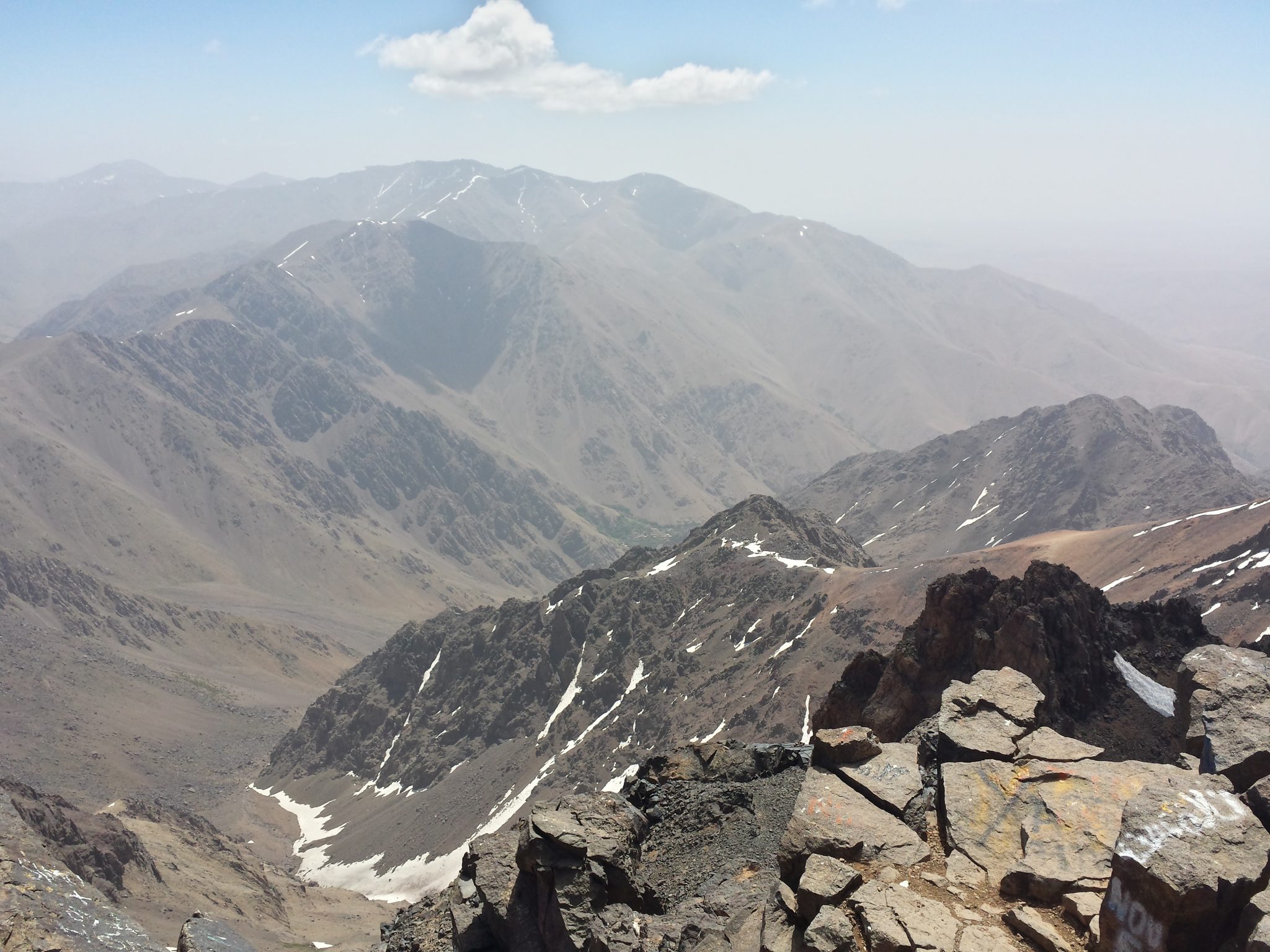
The summit, at a height of 4,167 metres (13,671 feet), is marked with a pyramidal metal structure.
Europeans first ascended this peak in 1923. Today, 92 years later, on the 20 May 2015, we reach the top of this beautiful mountain.

The effort of the climb was rewarded with amazing panoramic views of the Atlas Mountains with some streaks of snow that hadn’t yet melted.

Curiously, we found a dog sleeping on the summit. Later we learned that every morning this dog follows trekkers to the top and then returns in the evening to the refuge to be fed.
We descend by the same route to the col (Tizi’n’Toubkal), and then continued straight on to reach another summit—Toubkal West (4,033 metres).
After having climbed two 4,000 meter peaks in one day, we retrace our route back to the refuge and then return to the village of Aroumd.
Aroumd, at a height of 1,850 meters, is about half an hour’s walk from Imlil and is the largest village in the Mizane valley.
 The tiered fields consisting of barley, walnut trees, cherry trees, onions and potatoes, contrasts with the arid landscape of Toubkal. The track into the village is surrounded with very fragrant purple and yellow flora.
That night, we stayed in a local gîte offering stunning views of the Mizane valley from its large terrace. The local Berber people of this village live a very simple life but appear to be quite happy and relaxed.
The next day we used the services of a guide to explore the Mizane valley.
Towards the end of the week we returned to Marrakech and then flew back to our beautiful emerald isle.
We spent most of our week’s trip to Morocco in the mountains. The stunning beauty of these mountains surpassed my expectations and I look forward to returning someday. There is so much to see and do that one could spend months here.
INFORMATION ON CLIMBING TOUBKAL
In May of 2015, the exchange for the Moroccan Dirham (DH) was approximately 11 DH to €1. The prices shown below are based on this conversion rate.
Travel to Morocco:
Ryanair return flights from Dublin to Marrakesh: €120From the Airport, take the number 19 bus (€3) to the Jemma El Fna (Marrakech main square).
Accommodation in Morocco
There are a number of hotels near Jemma El Fna in the Medina. We stayed in the Sindi Sud hotel (€ 21 per night per room for two people), which was basic but comfortable and clean.
Transport to Mountains
The taxis which take you to the mountains are called “Grand Taxis”, as opposed to the “Petit Taxis” that are used in the city.
Take a Petit Taxi (€ 2) to the Grand Taxi rank at the Bab er-Rob taxi rank.
The journey from Marrakech to the village of Imlil is about 90 minutes. A shared taxi will cost about €5 per person sharing or about € 15 for an un-shared taxi, but be prepared to spend some time haggling to get that price.
Getting a taxi from Imlil back to Marrakech is more expensive and will cost €20 to €30 for a private taxi.
Mountain Refuge
There are three mountain huts clustered close together, with the lowest one being Les Mouflons.The Les Mouflons refuge costs €30 half-board per night.
Guides
Guides are available in Imlil and you will also meet them along the route and at the refuge. To get a good price, you will need to haggle. There are also options to use mules to carry your gear.
Hiking around the village Aroumd
A Gite with half-board (bed, evening meal and breakfast) should cost around €15 / night / person.