Skip to content
Irish Mountaineering Club IMC, Cumann Sléibhteoireachta na hÉireann
  • Facebook
  • Instagram
Join Now
Book the Hut
Members Login
  • About
    • Introduction
    • Contact Us
    • Documents
      • Constitution
      • Privacy Policy
    • Expeditions
    • Kindred Clubs, Handy Hostels
    • Library
    • People
  • Join
    • Introduction
    • New Membership
  • Blog
    • Article
    • Obituary
    • Review
    • Route Info
    • Training
    • Trip Report: International
    • Trip Report: Ireland
    • Other: Bottom of Home Page
  • Events
    • Introduction
    • Calendar
  • Hut
  • Publications
    • Introduction
    • Books
    • Newsletters
      • 2010-now
      • 2000-2009
      • 1990-1999
      • 1980-1989
      • 1970-1979
      • 1960-1969
      • 1950-1959
    • IMC Archive
    • Videos
  • Training
    • Overview
    • Introduction to Trad climbing Programme
Irish Mountaineering Club IMC, Cumann Sléibhteoireachta na hÉireann
  • Log In
  • Join the IMC
  • About
    • Introduction
    • Kindred Clubs, Handy Hostels
    • Library
  • Blog
    • Article
    • Obituary
    • Review
    • Training
    • Important Information
  • Events
    • Introduction
    • Calendar
  • Hut
  • Publications
    • Books
    • Newsletters
      • Newsletters 2010-2018
      • Newsletters 2000-2009
      • Newsletters 1990-1999
      • Newsletters 1980-1989
      • Newsletters 1970-1979
      • Newsletters 1960-1969
      • Newsletters 1950-1959
    • IMC Archive
    • Videos
  • Training
    • Overview
    • Introduction to Trad Climbing Programme 2026
Join Now
Book the Hut
Log in
  • A Game Of 3 Halves

    A Game Of 3 Halves

    The Gross Furkahorn, The Cresta Segantini
    and The Piz Badile

    PW and I have been keenly climbing in the Alps over the last 3 summers and we have allowed ourselves 10 days, each time, to adjust to altitude and conditions.   Our trips have been loosely based around the Piz Badile, with the aim to complete the climb on this, one of the great ridge climbs in the Alps, with 700 mtrs of clean rock at very amenable grades.

    We first went in mid-July and found that the snowfields proved too much of a challenge (in logistics).   Our next year was at the start of August, and again, the weather conditions did not allow the attempt.   That year, the climb was completed by Cearbhall and Dave Keogh who arrived as we left.   So another year in the Alps beckoned; to climb or fail on the actual route and with this in mind we travelled later in the month and put our plan and preparations in place.

     The Gross Furkahorn

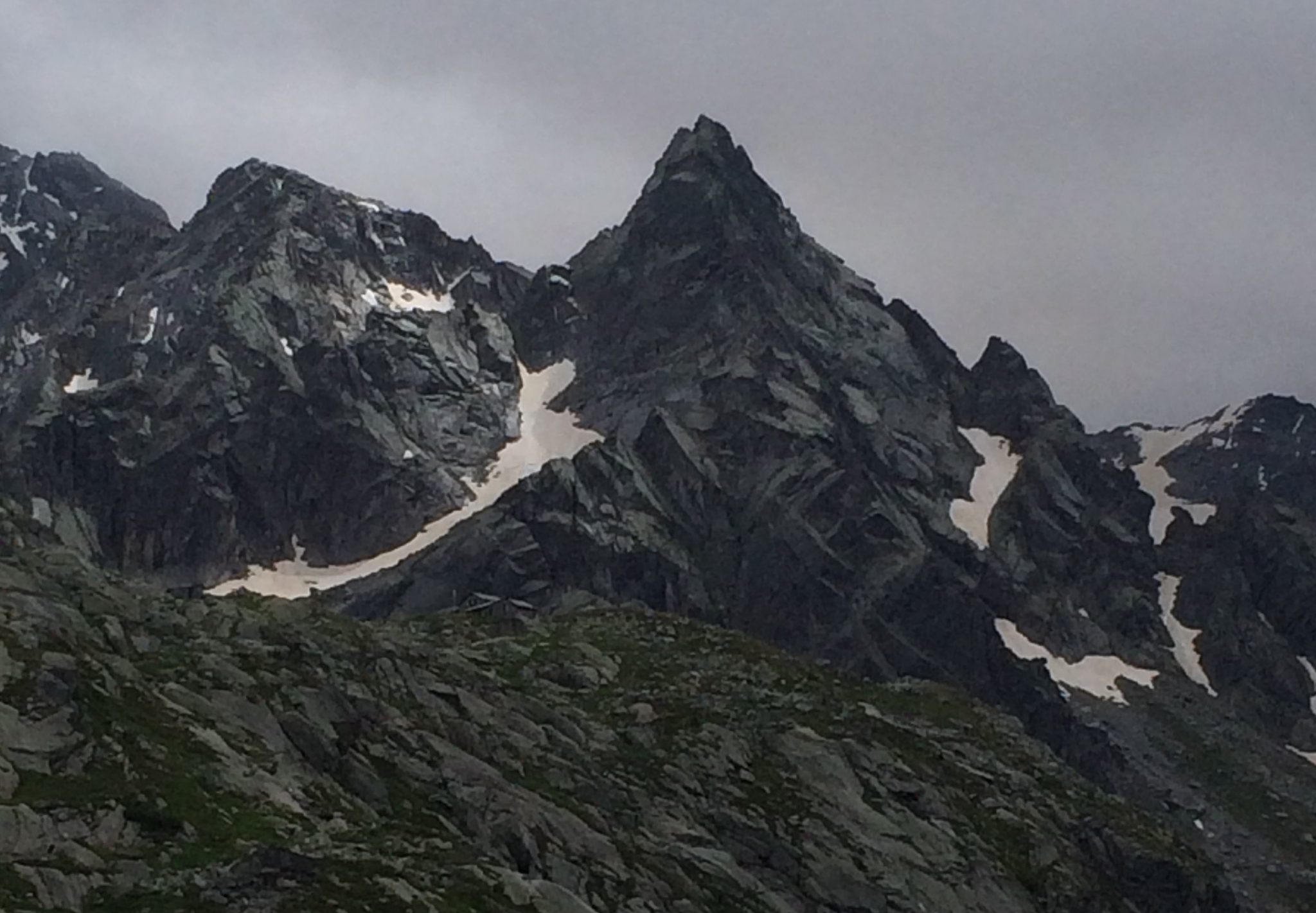
    Peter came up with the suggestion of going to the Uri Alps for a few days, to get some climbing in and to acclimatise.   He picked the Gross Furkahorn ridge, as it was a reasonably long route and it seemed the grade was doable, with the hardest route graded French 4c.   Blinded by enthusiasm, I forgot to apply the maxim “all guide book  grades and times should be treated as works of fiction”, I had plenty of time to think about this later.

    We arrived in Bergamo, collected our hire car and of course the weather was stunning  as we set off to drive past lake Como up in to Switzerland.   I was a little worried about the prices in Switzerland, as last year, I found them expensive.   This year the Swiss had stopped supporting  their currency and it had revalued by 20% against the Euro.    As we drove over the border from Italy, a dour Swiss Guard, insisted that we pull over into a siding  and buy a ticket.    Alas, this was not a raffle ticket for Harry Kane’s Cuckoo Clock, but a general toll for Motorway.   Welcome to Switzerland €45 please!   When we recovered from the shock, time for another one – €30 lunch at the service station!

    We came off the motorway after 20 kms and then on the D roads to the Furka Pass.    We had decided not to reserve places in the hut up from the pass, as it was midweek and we thought it would not be busy.   We briefly discussed whether we should ring from the car park, but decided we needed the walk anyway, arriving at the hut, only to discover, that the Swiss Army were in residence and the place was packed with squaddies, so Mien Host said  “no room at the inn”.   This turned out to be a blessing in disguise, as we trudged down the hill, back in the car, to a hostel some 2 kms away.  This Hostel / Hotel was a great base, the food was good and no sign of powdered potatoes anywhere!

    When we asked what time for breakfast, they replied that they had one group at 4:30 and another at 6:30, we thought ; easy route – we’ll go for the 6:30, on reflection a little late for a big days climbing.

    We got to the parking spot at 7am next morning and started the pull up to the base of the climb. Our interpretation of the guide book instructions was to climb almost to the hut, then climb up the glacier and cross the glacier on the more level side.   As we approached the glacier from the left side we saw a way to shortcut this traverse, left to come back right.   There was a hill slope above us, which was heavily bouldered, and it seemed to make sense to climb this and avoid the tedium of crampons, axes etc.   Agreeing this course of action we set off up the slope from boulder to boulder but after some 10 mtrs or so it dawned on both of us that this was an angled glacier, with a boulder field sitting on top and it would take only one move, to start a big boulder slide, a strategic retreat was hastily made.

    We followed the guide book route and traversed up the snowfield and glacier, crossed higher up, reached the lower area of the Gross Furkahorn and scrambled up to the base of the climb.

    Having reached the base of the climb at 9:45am, we discussed whether it was too late to start as there was a German climbing team gearing up to go and they were very slow to get started.   We decided on our usual formula of climbing 3 or 4 pitches and abseiling off, if it was too slow.   The first and second pitch of this climb had a guide book rating of 4c French, but there was no doubt, here in Ireland, we would grade them 4b VS .   Peter led off, huffed and puffed and he would have liked an easier start for the first morning climbing, at an altitude of 2,800 meters, having only arrived the previous day and not yet acclimatized.   I followed, struggled up onto the airy arête and then off on the left for an overhanging horizontal crack climb which reminded me of the Mourne’s type climbing.    Climbing was demanding and our progress was slow.   The German team ahead were very friendly, not fast, and their rope work was a mess.   On pitch 4 Peter arrived on the belay to tell me that we had a Swiss guide right up our rear and it seemed that crowding would get only worse.  I was concerned about the Swiss guide, as they have a reputation for being notoriously unfriendly and obnoxious.  We were fortunate that day as the guide was good crack and as we shared belays all day, we had wide ranging discussions on music (we both had played in bands), the dangers of alcoholism from bands and, as he explained, the job of guide was a double whammy and he had to be very careful with everybody in party mood on holiday etc.

    At this stage the Swiss guide was muttering about the German team ahead, saying they were slow and he would not be delayed.  Peter and I were also losing patience, wanting to overtake and move on, as we had fully committed to the climb.  The Swiss guide and ourselves put some pressure on the German team.   They decided to stop for lunch and we happily steamed ahead.   The guide had a client that was reasonably fit but not a very skilled climber, so he was happy to stay behind us and we progressed up the ridge pitch after pitch.   The Guide book had no indication of how many pitches and gave a climbing time of 4 to 6 hours.   We did not  count the pitches but reckon there were between 12-14, not what we expected for a first day’s easy climbing.   Somewhere around pitch 9, the climb moves off the arête and descends 20 mtrs to the left and returns after 50 mtrs, none of this is very obvious and without the guide offering route advice we might have taken a few wrong turns and lost time.   I was discussing the nature of the route with the guide and although there were bolted belays,  there were no more than 10 or 12 more bolts on the whole route.   He was of the opinion that it was one of the better alpine routes, because it was not disfigured by masses of protection and you had to use the rack all the way.  I led another interesting pitch which was a 5 mtr crack climb, on almost vertical slab, this had a bolt at the bottom, but if you fell at the top it would be 13 mtr winger!   This was a rounded crack, so protection would not work, but there was a great lip to hold on to – nothing for it but to get on there and keep moving till the arête thankfully was there to grab again.

    We climbed on, pitching even on the short relatively flat area near the top, we arrived at the base of the 3rd last pitch and watched a new team of climbers (they may have been on another climb which joined ours) struggle up a layback crack.   This looked so difficult, the lead climber struggled and the second also struggled and I thought, this climb is getting harder nearer the top, we are exhausted and need it easier.   At this stage, the Guide decided his tea was getting cold and said he would go first and he powered up the climb.    His hapless client was subjected to a lot of friendly abuse, to make her move faster, as she had run out of steam.   I was secretly glad that Peter was leading this one as he got ready to go!   Peter ignored the layback crack, moved left and swung effortlessly onto a jug and powered up the wall.   The next pitch was straight forward and then for the last and most difficult pitch, PW was up again, phew!   The guide’s client was now receiving a lot of advice, abuse and extortion’s to speed up and keep moving on this slightly overhanging pitch.

    This pitch reminded me of Streetfighter in Dalkey quarry, but is was more difficult and twice the length.   This would not normally be a problem for Peter or I in the quarry, or Glendalough, but at 3169 mtrs after almost 6 hours non-stop climbing, it was demanding……I was glad to hear the “climb when ready” shout and followed up to join Peter at the top.  This climb literally finished at the top of the mountain, from the stance you could reach up to the highest point, which was exhilarating.  So then on to a 25 mtr abseil, to the gap and some down-climbing to a traverse around the mountain, to another abseil 45 mtrs, a long trudge through a   snowfield and again a nasty 70 mtr down-climb on very exposed ground holding on to grass and muck.   At this point we could see the valley below and mapped out a route through the boulder-field to the river and then follow the river to the path.   That was the plan, although, we spent a lot of time in the boulder-field and had to turn back a number of times, encountering big drop-offs berschrunds  etc .   We finally made it to the path, at approx. 8:45 and we were both musing on the fact that the kitchen in the hostel had a strict closing time of 9pm.  We had not eaten all day and would have to scrounge for sandwiches and chocolate etc, but then my phone rang, mindful of my last disaster answering my phone!  I stopped walking and saw a Swiss number – Swiss motorways ringing for more money perhaps? Extra tax for walking too long on the Mountain?   No it was the manager of the Hostel, worried about us and wanted to know we were safe.   My faith in the Swiss nation was restored, as she assured us that, yes they would keep the kitchen open and we did not have to go to bed hungry.

    A great day’s climbing in sunshine, we completed the climbing part of the day in 5.45 hours, inside the guide book time and would have been faster without the initial delays.   This was the most difficult climbing of the long days I had done in the Alps yet, the walk in and walk out were extended but the climbing was right, this was a quality day that never looked like descending into an IMC epic!!

    Length of climb 375 mtrs , height at finish 3169mtrs
    POL Test: Passed

    Cresta Segantini

    The next day, despite the weather forecast, was sunny and would have been good for a day’s climbing, except we both needed to recover from our “quality” day before.    We toured around the Uri canton, while Peter revisited his long forgotten Ski trip (it is always interesting to see the mountains you only knew covered in snow in the summer) and took in Andermatt and its hinterlands.   The following day was for traveling, the weather was excellent again with thunderstorms forecast for that evening.

    We decided on a long circuitous route to take us down to Chiavenna in Italy, through the Spelugen pass, for me this was the most dangerous part of the week, I found this description in a guide

    ‘’If you take a left here in Pinazzo, you will find the road running through the “old” Spluegen pass road, through extremely narrow rock tunnels. This way is closed for trucks and campers and asks for extended driving skills with a little challenge. Caution is required, since the tunnels only have space for a car in the tunnel width and usually a bend or curve is inside the middle of it. Ideally, when you want to ride the challenging “old” pass route, we recommend to take it from the south to north, uphill coming up from Chiavenna. Downhill the road  is not as smooth to drive We always recommend – if you ride the Spluegen downhill – choose the right option, going uphill, then you really should take the challenge to ride the “old road”.”

    We reached Chiavenna presently and I had to help my driver to the restaurant for his recovery.    We continued with a climbing trip staple, a visit to the outdoor shop to buy more unnecessary gear!   Reaching our destination later that day, the Hotel Sala in Interobio, which is in the next valley to Como in the valley of Valsassina.    It is here you access the start of the Segantini ridge.

    The forecast for the following day was showers and thunder storms in the afternoon, so we decided on an early start leaving at 6am.   We reached the car parking at approx. 7 am the next morning and started the walk in to the start of the climb. The guide book time was 2.15 hours for this part, as it included some vertical ladders, fixed cables and chains.   We reached the start after two hours and discovered two Italians also starting.  Relieved to see they were climbing some higher graded variation of the climb, so we would be with them most of the day, but they would not be slowing us down.   We decided to pitch the first section, having remembered from last year, there was a very nasty step over a void, onto an overhanging wall.   Peter led off and immediately showered both the Italian belayer and I, with loose rock, which seemed a bad omen for the day.  This was reinforced when the Italian lead climber decided to join the rock throwing competition and had us both jumping for cover!

    After the step over, we decided to rope up and move together and move fast (the weather was about to change) so  pitching was out.   Last year we attempted this route with Barry and Vinny, pitching every section, and only managed a quarter of the climb after a few hours and were then forced off by the bad weather.   This climb is graded from 2 to 3c throughout but probably under-graded at that, on the harder section it may be 4b, but not too serious.   The problem for me with this climb was the back climbing, I had problems last year and when you are a second, you could take a very nasty fall with no protection above you.  I have always had a problem with back climbing and decided to spend some time on practice on the climbing wall after last year’s attempt.   Although I did not stick with it, I discovered my terrible fear of climbing down was now just the normal fear that keeps you making careful moves, I was enjoying the down climbing as much as the up……

    Who says you can’t find a virgin when you need one!

    So the climbing went on, this ridge is approx. 500 mtrs long and gains approx. 270 mtrs in height so there is a lot of ground to cover.   We alternated leads when we ran out of protection and made great progress, reaching the summit in glorious sunshine after approx. 4 hours climbing.   The decent was a steep treacherous walk off and 10 mins before we reached the car the heavens opened – I remember thinking they do get the forecasts right.

    POL Test: Failed 

    The following day was the repeat “day after” rest and climber’s retail therapy, with a trip to Decathlon in Sondrio, followed by a gourmet lunch in one of Barry Watt’s recommended restaurants.   We dined that evening in the garden terrace of our hotel, sheltering under the large umbrella/ shades when the rain showers started.   Peter who cannot judge his own strength, pushed the sunshade and with a crack it broke and another perilous moment, as the shade toppled – with me thinking, we had a small lightning strike.   This provided major entertainment for us and the staff and the other inmates.

     Piz Badile

    The weather window was okay for the next day, with some rain forecast through the night, but Wednesday was to be good all day and the Badile was on.  We drove up through Chiavenna into Switzerland and on to Bondo, where you leave the main road and donate another €10 to the poor roadmakers of Switzerland for the privilege of driving up the road a bit for an easier hike.   Hiking up to the Sasc Fura Hut, it was full sun 27 degC and with the full load of Bivvy gear, I was wrecked when we got up the 700 mtrs of almost vertical path.

    Peter and I decided to do some Yoga in Drag to pass the time and have something to eat before moving up the hill.   The Rosti was okay for lunch but at €19 was a 5 star price.

    When we recovered from the Rosti (price) and the Yoga, we set off to hike the next 600 mtrs to get us up to the start of the climb and our bivvy site.   After a lot of huffing and puffing, we were up to the pass that brings you over to the Scirora hut.    The pass is closed now, as one of the mountains in the area is in the process of falling down and they expect a serious amount of rock to fire down the mountain at any time (taking out in the process part of the Sasc Fura path).    3 years ago there were some serious rock falls when we climbed in the area and the path to the pass had been blocked in a number of areas, the moving mountain was not understood at that time!

    We pushed on to the bivvy site, this is a series of shelters formed by leaning boulders to which various climbers had added some Galway-style dry stone, to give some protection from the weather.   We found one such “cave”, but a group of helpful Italian Climbers showed us a better one, which they guaranteed was dry in the worst conditions, we believed them.  We settled in for, as we hoped, a comfortable dry night.   I cursed the bivvy bag I borrowed from Ian C and thought all that weight carried up the mountain and it was a waste.

    PW headed up to the start of the face to check out our opening move the next day and when he returned we discussed the climb.   I had been intimidated by the sheer size and length of the climb in the past.   We both were pleasantly surprised at how the climb looked, positively benign from up close and the ridge was at a very amenable angle.   Our timetable was set the alarm for 5am, beat the crowd in the hut onto the face and all the other slackers………  Then it started to rain, our dry cave was better than sleeping out, but as water began to run along the inside of the roof and drip down, I felt I was in for a soggy night, that’s when I remembered Ian’s bivvy bag!   Once in the bag, I was snug and dry, and thinking to myself how perceptive I was and well prepared  – all previous thoughts forgotten.

    When we discussed the bivvy at the base of the climb, I had memories of Gaston Rebuffat’s great stories of the majesty of the Alps, the vast open spaces, the big sky, and most of all the solitude of it all.     What we found was that it was as busy up at the bivvy as O’Connell St at 3 am on Saturday night, there were people partying and shouting till all hours and only (like Dublin) the rain shut them up.   So a fitful night’s sleep and awake at 5 to discover a party of huttites passing with their head torches and a bigger group up at the face.   With the 60 people on the mountain, some altitude problems and lack of sleep, we decided to abandon the attempt and head down the mountain once again.   I was not unhappy to leave, it just did not seem like the right day, and if there is always going to be 60 people on the face I don’t think I want to join the queue.   I think the only way to get a clear lead would be padlock yourself to the first bolt at midnight.    Like all trips, the fun and entertainment happens as part of the journey and the sense of fulfilment is not only in reaching the summit, but what happens on the way.   Two out of three ain’t bad.

    POL Test: Passed

    Notes

    POL Test

    The POL Test was commissioned by the committee of the IMC to determine when we could call a day out mountaineering. Paddy O’Leary (hence the POL) a renowned member working with the finest climbing talent in the Club came up with a simple but brilliant formula  ‘’ if you are back in time for tea you have not been mountaineering’’

    Some problems have arisen with this in recent times , i.e. if you are so incompetent that you end up on the massive epic and are out till 5 am, you have been mountaineering! This is now under review.
     

  • Journeys Into Val Bregaglia

    Journeys Into Val Bregaglia

    Wanderings and excursions in the country south of St. Moritz and the Italian borderlands of southern Switzerland.

    German efficiency being legendary, that’s where Dave recently went on a trip to study their house building methods. Being so close to the Alps was not a climbing opportunity to be missed, so with his training complete, I flew out to join him, and we decided to head to the Bregaglia in the south-east of Switzerland.
    On arrival the forecast was not great so we continued on into Italy where we caught up with Peter, Kevin, Barry and Vincent in Chiavenna relaxing after a week’s climbing. It was clear that these boys had gone soft, slumming it in the Hotel Conradi and overindulging on pizza and vino rosso. Their climbing ropes had been long packed away, so we relieved them of a few guide books and continued on to the Val di Massina in search of better weather. We were out of luck on that score, but after two days the deluge ceased and we finally got on some rock, spending a balmy day on Europe’s biggest boulder, Sasso di Remenno.

    Sasso di Remenno

    Dave’s appetite for alpine rock was truly whetted now so the next morning we broke camp and headed back to Vicosoprano in Switzerland. A short gondola ride had us at the Albigna Dam and we headed up the Spazzacaldeira for a warm up on the NE Ridge followed by the obligatory photoshoot on the Fiamma.

    La Fiamma, Spazzacaldeira

    The forecast for the next day was just too good so we decided to go for broke and headed for Val Bondesca to try the Nordkante of the Piz Badile. Grabbing some supplies in the valley we took the toll road to Laret and after a brief stop to cook some gourmet roadside pasta, we started the long hike up to the Sasc Fura hut.

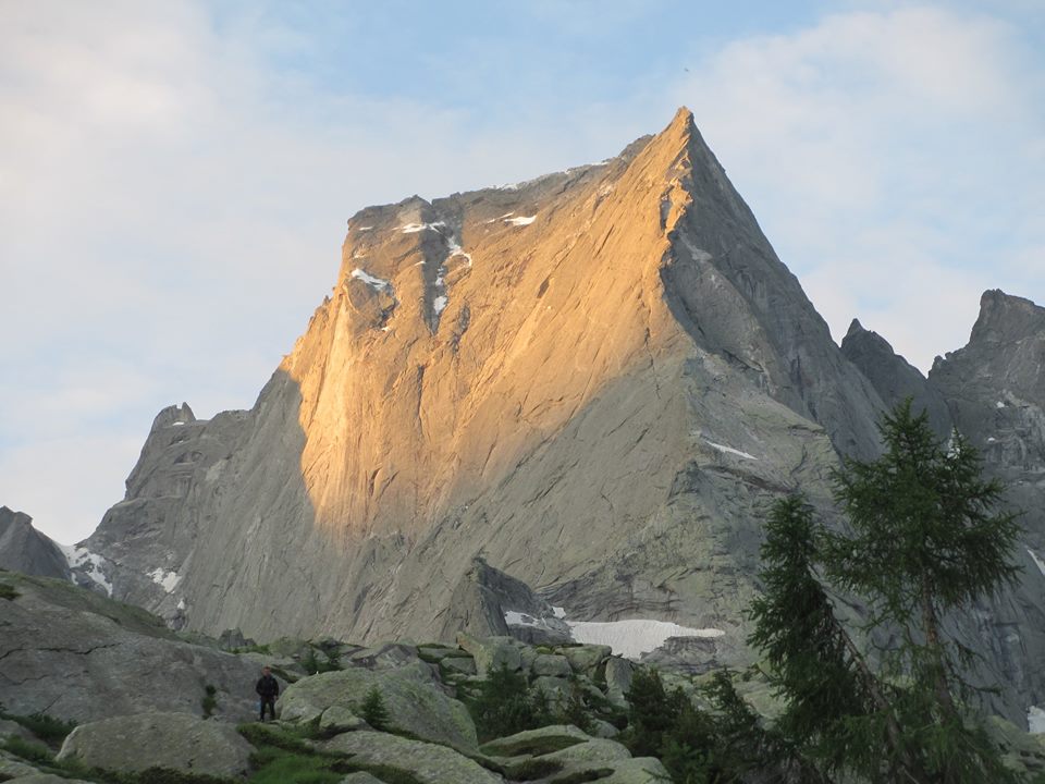
    Piz Badile

    We managed to resist the heady attractions of the hut itself and continued on up to the base of the ridge where we bivvied as darkness fell on a starry night. Next morning after a quick breakfast, we stashed our kit and joined the procession of headtorches slowly making their way to the ridge. The light of dawn soon revealed the size of the task at hand, 19 pitches and c. 1000m of climbing, not to mention getting back down.

    1471279_10152422896038716_6996887195556316270_n

    It was probably 15 pitches more than either of us had done on a route before which might explain why we always seems to be “maybe 4 pitches from the top”. The climbing was on pristine granite, and while never difficult, it seemed to go on forever.

    10710883_10152422898598716_2863397766167310610_n

    The other parties on the route soon spread out, and after passing a few slow teams at the bottom while moving together, we then had the route to ourselves apart from one old timer who passed through on a solo mission, and later a couple of parties we met near the top who were downclimbing having already finished the route.

    10628007_10152422898573716_7859929677300583902_n 10605997_10152422896863716_2365042094159117000_n

    On and on and on we climbed…until finally we topped out at around 2pm having been on the route since 7am. Although the Gianetti hut on the Italian side now looked almost in touching distance, to avoid the snow-plod from Italy back to Switzerland, we had already decided to ab back down the ridge.

    10392417_10152422898968716_2447401544848612151_n 10347803_10152422901528716_1937172370220736197_n

    Seven hours of daylight seemed adequate to descend but it just seemed to evaporate. Each rope pull felt like we were rolling dice but luckily we only had to reclimb  one pitch to retrieve a stuck rope. The last few abs left us fumbling in darkness searching to find the next anchor, but after a few wrong turns we finally made it to the foot of the climb.
    After crossing the snowfields we were now on easy ground but with little hope of finding our gear, so we settled for another night bivying in the meadows…maybe the ab into Italy would have been a more sensible option after all. Next morning we collected our gear and trecked down to the valley, reaching our car forty hours after having left it.
    After two nights under the stars there was nothing left but to follow in the footsteps of those brave IMC pioneers who had gone before us, so we beat a hasty retreat to the Hotel Conradi…I think we’d earned it.

  • Bregaglia Rocks (or the strange case of the missing helmet)

    Bregaglia Rocks (or the strange case of the missing helmet)

    Last year, Kevin Coakley and I had travelled to the Bregaglia in Switzerland, with a view to climbing the infamous Piz Badile. Weather and conditions worked against us, so this year we decided to try again. We were joined by experienced IMC members, Vincent ‘Doc’ Astier, and Barry Watts.

    (more…)

  • The Cassin Route, Piz Badile

    (by Dermot Shiels, from IMC Newsletter Autumn 2010)
    A lightweight ascent of one of the Alps’ Great North Faces.


    Like many climbing plans the idea for this one was spawned at the climbing wall one rainy evening. Neil Wilson and I had discussed different alpine routes in the past and had our own wish lists but we shared a craving to climb the Cassin route. I could only get away for a few days and Neil was moving to Haiti to work for a few months at the end of the summer. So we started the preparations …

    The Cassin Route takes a more-or-less straight line up the centre of The North East face of the Piz Badile. It is one of the walls that Gaston Rébuffat dubbed one of the six great north faces of the Alps back in the 1930’s. The epic ascent by Cassin and co and the subsequent horror-story descent when two of his companions died lays testament to the seriousness of the route at that time.

    The route has equipped belays now and some fixed gear where it matters so the technical difficulty is now reduced. The use of modern gear, energy gels and up-to-date weather forecasts also make a dramatic difference today. However Cassin’s reputation remains and it makes you sit up and take the undertaking seriously when you are considering having a go or when you are standing at the base of it looking up!


    One of our topos

    To prepare ourselves we read numerous climbing reports from other climbers. We studied the gear they used, the clothes they wore, the food they ate and the topos they used. We found three independent topos of the route with subtle differences and studied them in depth before we left for the climb. We decided to travel as light as we could so as to climb faster. But we expected there was a fair chance we would be forced to bivi on the route or on the descent down the North Ridge. Due to our time constraints there would be no warm-up route, just the Cassin, so we had to be organised.

    We flew to Milan on the red-eye flight from Dublin and drove our rental car north along the shores of Lake Como to get to the Swiss village of Bondo. This is at the foot of the Piz Badile in the Bregaglia mountains. Luckily you can drive from Bondo to an upper car park reducing the walk-in time to the Sasc Fura hut to under two hours up a nice shaded forest track.

    As we stepped out of the car to shoulder our bags we caught our first glimpse of the North Ridge and the twin North faces of the Badile. Simply put, we were awe-struck. It is a striking mountain and the gravity of what faced us landed in the pit of our stomachs. How are we going to climb that?


    Piz Badile, North-east Face on the left

    The climb is a rock route in summer months with three of the 25 pitches at about 5c+. Climbers traditionally carry their own gear alpine-style with a small bag each. Therefore we gambled on using approach shoes and left our heavy mountain boots and ice climbing gear behind to save weight.

    We were climbing the route early in the season and consequently there were no footprints to follow on the initial snowfield. This must be traversed to get established in the middle of the North-East Face. We spent a lot of time creeping across this snowfield in our approach shoes kicking steps and balancing with a home-made walking stick I found at the foot of the North Ridge.


    Dermot on the first snowfield

    There was a 50m run-out from belay to belay on the snowfield so we had no regrets taking our time, as it would be a bad idea to rush across without crampons and axes.

    We had read of an unfortunate accident at this spot in recent years which played on our minds. And to top it off the German frau warden in the hut told us the night before that it was impossible without ice gear and not to do it under any circumstance. This resulted in a sleepless night wrestling with our inner demons and making the tension more intense at that crucial part of the route. But we committed and found a way across, the tension eased away and the fun began.

    There was nobody else climbing that day so we had the entire North-East Face to ourselves. This made the experience all the richer. It was great to be alone with your thoughts as you climbed the best quality granite cracks and slabs and then to sit on the belay ledges soaking up the exposure above, below and all around us. The face is the biggest either of us had climbed so far, 800m of vertical climbing once you are established beyond the snow fields.


    Half-way up the face

    We thoroughly enjoyed the climbing and the weather was great until we were about two-thirds of the way up. Just as Neil reached the hanging belay under the second crux the thunder clouds rolled in and the skies opened up. I scurried up after him and we set about getting our bivi bags out. Neil was hanging on three or four pitons and I was on two camalots. The rain was pouring down the face in a waterfall off the overhang above us making things a bit more interesting. We juggled our gear about, clipping everything onto the belay and bumped into each other as we pulled up the bivi bags to escape the deluge.

    The rain lasted about two hours I think, but after that a few rays of sun made it through a gap in the clouds and lifted our spirits. We quickly packed up and I aided up the crux corner as it was dripping wet. Then Neil led through up a long difficult slab pitch to get us into the exit chimneys.

    Completely dehydrated he helped himself to a pool of rainwater conveniently located at his head level, no hands, he just dropped his face in and sucked it up (standards were dropping!). I climbed through into the exit chimneys where we found a good ledge to call home for the night and we settled in.


    Bed time in the exit chimneys


    Morning in the exit chimneys

    The following morning brought clear skies and a welcome sun. We set off early up the last two pitches of the chimney, which had a little ice in places. Then we made our way across to the slabs that bring you to the summit ridge, baked in the morning sunshine. We relaxed for a short while in a notch in the ridge peering into the other valleys and back down the face, two specks on the top of the Black Dwarf. Mindful of the long descent that awaited us we couldn’t hang around for long.


    Neil near the summit ridge

    The clouds built up again at times but luckily there was no more rain. So the twenty abseils down the magnificent North Ridge went without any trouble. We made it down to the hut with big appetites and a warm welcome back from the wardens, even a wink from the Fräulein! The quality of the climbing, the exposure, the feeling of remoteness, the company, the history, the hut … it was brilliant.


    Sasc Fura Hut, Piz Badile above

    Gear we used: light rain jackets, two pairs of gloves each, hats, balaclavas, dryflow tops, 1 light fleece each, light weight bivi bags, down jackets, head torches,  6 energy gels each, 3 litres of water each, a couple of bars of chocolate, 1 set of wires, 5 or 6 friends, 10 lightweight extenders, slings and locking crabs. We left behind rainproof leggings, sleeping bags and ice climbing gear to cut down on weight.

  • A day on the Nordkante

    (by Conor Warner, August 2008)
    An ascent of the north ridge of the Piz Badile.


    It was Monday 7th July, it was lashing, and we just had to get out of the camp site and away out of the valley. It had been raining more or less continuously since we were rained off the north-east ridge (or central spur) of the Spazzacaldera early on the Sunday morning. James and Barry had already spent the previous week in the Bernese Oberland where they climbed a number of wonderful snowy peaks, while I had just arrived on the Friday into Zürich. On the Saturday, which was a cracking day, the three of us, Barry, James and myself, climbed the south ridge on Piz Balzet (III / IV) (a relatively short but excellent route on prefect granite), descended the east ridge (after having a bit of banter on the top with a few wandering Milanese), followed by a short trek down marmot-infested slopes back down the Albigna Hut where we stayed over the night very comfortably.


    Photo 1: South Ridge on Piz Balzet

    The next morning Barry and I attempted the route on Spazzacaldera, as mentioned above, before retreating back down to the Vicosprano via the compact cable car and zooming down across the border to euro land to Chiavenna for a mountain of Italian food in a side-street restaurant.

    Barry and I had set our sights on completing two other routes before the trip was over namely the Meuli Route on the Punta da l’Albigna and the North Ridge of the Piz Badile.

    The weather forecast however looked ominous. Tuesday looked like being the best day with the weather set to deteriorate on Wednesday and the remainder of the week lapsing into thunderstorms with downpours. So, having discussed plans with the mountain guides at the MCI meet and having contacted the guardian of the Sasc Faru hut, we decided to pull out all the stops and head straight for an attempt on the North Ridge of the Piz Badile. James dropped us off at Laret (1,252m) which is reached by a private steep winding toll road above Bondo. From there we trudged our way up through larch forest and dense undergrowth via a winding path, crossing several rivers en route, in literally a continuous downpour to the Sasc Faru hut (1904m).


    Photo 2: Tuesday morning, a view of the north ridge from the Sasc Faru Hut

    The guardian, Heidi, was very welcoming (considering we were the only two booked for that night) and amused when she saw the state of us, soaked to the bone, drowneded cats, Paddies on tour. She advised us that the weather forecast had changed and that the weather was set to improve from Tuesday morning onwards and that both Wednesday and Thursday looked like being settled, warm and sunny, and basically that we should hold off going for the route until the Wednesday when a number of other teams were also going to give it go. Local wisdom. That evening we discussed the route in depth with Heidi (she had climbed the north ridge twice), read up the various guide book (in German) that were available in the hut, with particular attention to the descent route (read the pictures), had a few beers and hit the sack.

    On Tuesday morning we dried out our gear, chilled out until noon and read up on the route a little more. We then decided to walk up to 2,400m just below the route proper to give it a good reckie and to stash our gear so as save us the effort of lugging up a heavy load the following morning. (note: between 2,300m and 2,400m there were plenty of good bivy sites and running water from springs). The reckie proved invaluable, helping us to visualise and plan the route; the initial snow field and slabs up to the col at 2,589m, the start of the ridge, the Risch slab and its overhang, the daunting ridge above, the crux section, another steep looking ridge section, another large slab (which we nicknamed the Shimmering Slab), and above that the route seemed to continue endlessly to a ever-narrowing ridge. The rock looked dull grey, smooth and compact and the ridge as a whole looked somewhat like the prow of an upturned US navy aircraft carrier.


    Photo 3: Tuesday afternoon, a view of the north ridge on the way to 2,400m

    Piz Badile was first climbed in July 1867 by William Coolidge with guides F. and H. Dévouassoud by the south face, while the north ridge, also known locally as the Nordkante, wasn’t climbed until 4th August 1923 by Alfred Zürcher with the guide Walter Risch. From 2,400m we could vaguely view on the east face the line of one of the most famous routes in the Alps, the Cassin Route, which was infamously climbed in July 1937 by Riccardo Cassin, V. Ratti, G. Esposito, Mario Molteni and Giuseppe Valsecchi. Heidi had informed us the evening before that Cassin still lived locally.

    When we got back down to the hut other groups had already arrived and there was a buzz about the place. We relaxed for the rest of the evening, had dinner and hit the sack early enough planning to be up and at ‘em around 3:30am so as to get out by 4:00am.

    We left the hut at 4:10am in darkness and with the aid of head torches arrived in good time at our stash point, just below the final snow fields. We donned our harness, arranged our gear and with ice axes made our way to the col (2,589m) at the start of the route on the north ridge, where we roped up, put on our climbing shoes, put away our axes and set off moving together. By 6:20am, under clear blue morning skies, the five groups who were attempting the route were established on the ridge, consisting of two Austrians, two Italians, three Swiss, two Czechs and ourselves, two Irish.

    I led up the first section, moving together over relatively straightforward terrain of perfect granite (II/III/-IV), starting on the left side of the ridge before moving up on to the crest and on from there, with some exposure, to the base of the Risch slab (about 170m up from the col). The Austrians were just preparing to pitch the slab. Barry took over the lead. He started up on the left side, continued to under the overhang at the top and worked out right to exit the slab (IV+). During the next four or five superb pitches of (IV/+IV) of slab and dièdre climbing on the ridge proper, there was considerable traffic and delay with the position of 2nd, 3rd and 4th on the ridge continually changing between us, the Swiss and the Italians, while the Austrians stormed ahead. The interaction between the groups was in general good humoured, with the odd bit of f-in and blinding at the Italians over some ungentlemanly climbing behavior (simply just not cricket!). During these pitches, which were amazingly exposed and weaved from one side of the crest to the other, from bright sunshine to shade, the temperature plummeted as a wind gusted from the east. These proved to be the toughest pitches of the route due to a combination of the sustained climbing, the cold and the jostling for position.

    We arrived at a stance that appeared to have two options, to traverse left below the ridge or go right across the ridge passing through a tight dièdre (which the guide book advised was the correct way). I got jammed in the dièdre with my big west-of-Ireland shoulders but managed to barge my way up to the next belay point, with Barry awaiting, grinning, pointing to the crux pitch. The crux pitch (-V) took the form of a short steep wall involving some easy bouldering moves, with lots of in-situ bolts and unlike the section of the ridge before, not in an overly exposed position.


    Photo 4: Glorious climbing on the North Ridge

    With the crux completed, the ridge eased for two pitches (III/-IV), with some short dièdres with some loose stone, that led to the base of the ‘Shimmering Slab’. This slab (IV) was climbed via numerous cracks; reminiscent of ‘Skull Slab’ at Aill na Crónáin back home in the Burren. From the top of this slab the route continued to another dièdre that traversed up across to the right side of the ridge and disappeared around a corner. The next belay stance was in an outrageously exposed position, a small sentry post situated on an overhanging ledge covered in snow with the full extent of the vertical north west face visible directly below. Barry led from there (-IV) on around to the right, singing a wee tune, leaving me with my thoughts. Each belay turnover took only moments with very little said, just the odd “ya horse!” and “you’re on”, “climb when ready”, “climbing” and “best of luck ya ol’ mucker”.

    The climbing grade eased after the next pitch (-IV) and I took over the lead at this point giving Barry a very well-earned break. The next few pitches rose up over easy slabs (III) from one side of the ridge to the other, then mostly on the right-hand side avoiding small gendarmes with the occasional short back-climb until a small col was reached just before a posed block. We could see the top. From this col the route followed down to the left along a small narrow, snow-covered, gangway avoiding the last prominent gendarme before reaching a short tunnel between huge boulders that otherwise blocked the ridge. From the tunnel and after some easy terrain we had gained the summit at 3,305m.


    Photo 5: Evening abseiling down the south face.

    The North Ridge of Piz Badile was climbed. With over 10 hours since the col at 2,589m, 22-plus pitches of continuous glorious climbing on superb granite, we had now to turn our attentions to getting down the south face to the Gianetti Hut.

    The pair of Italians had just started descending from the peak when we had arrived. We could hear the Swiss team further below while the Czech team had turned back several hours before, opting to abseil back down the North Ridge. The Austrians, we imagined, were sipping coffee in the hut by that stage.

    We changed into our big boots, had a quick snack, gathered ourselves and started the descent from immediately below the summit trig point via a short chimney (into Italy) to the top of the descent route that is defined on the east side of by a steep couloir and on the west side by the south ridge. The guide book suggested that we should descend the top section of the couloir. On closer inspection of the snow- and rubble-filled couloir, we decided to set up an abseil and descend down the slabs to the right of couloir. We could see the Italians immediately below us in some confusion, slipping in the couloir and untangling their ropes. I backed up an existing abseil point with some 8mm tat that I’d brought along and we started to arrange our two 50m ropes for the descent. One of the Italians came bolting back up to our newly set up abseil point and threaded their ropes through before we had a chance to get started (as I said early, simply just not cricket!). After an inconvenient delay we then abseiled down to another ledge and lo and behold there was an abseil point and some streaks of orange paint to indicate the descent route. Sorted! For the next few abseils the Italians were slowing us up big time and they kept asking which way now and then they’d rush off down ahead of us. At the end of our second 50m abseil we noticed that the pair of Italians were preparing to abseil down the right hand side of the ridge via a new looking bolt and chain abseil point. Like a haunting memory we remembered Heidi, back at the hut, warning us not to abseil down via this chain saying “you must stay on the left side of the ridge until the cross!” and that there was another abseil point further along the ledge. And there was. We convinced the Italians to follow us, away from their deaths, and we reconvened our descent down the south face.

    Four 50m abseils down from the top of the couloir (from just below the summit trig) brought us to a ledge and narrow track that led down parallel to the ridge to another abseil point. This abseil led down to another ledge at the bottom of the couloir where another abseil point awaited. The Italians kept slowing us up and, despite our best efforts, we couldn’t get past them. Awkward individuals. We then convinced them to abseil down our ropes to speed things up as their ropes kept getting tangled and they seemed to be all up in a heap. I set up the abseil down and then one, then the other Italian and then Barry followed. This abseil ended at the path way to the cross which Heidi, like the oracle, had warned us was difficult to find. The path went down a bit, right a bit, up a bit (not down which is where some apparently go wrong), across a bit, left a bit and steeply down a bit to a ledge at the top of sheer gully which was marked by a metal cross erected by the Italian Climbing Federation. This cross doubled as the abseil point, or so all the tat suggested. Another nearly 50m-long free-hanging abseil, this time down the right-hand side of the ridge led to the final abseil point. By this stage it was getting late and the Gianetti hut, which had been visible for a lot of the descent, was lost in the darkness. The final abseil led down onto a snow field (c 2,900m) with a trail of foot prints leading to the moraine. We packed away our ropes, donned our head torches, and set off down to the hut in the dark. The Nordkante was climbed and the south face descended! Job done! Myself and Wattsie roared out an ol’ Clare shout, shocking the Italians a bit and fumbled our way down guided by the outside hut light that the guardian had put on when he spotted our head torches.


    Photo 6: Panorama of the south side of Punta Torelli, Punta Santa Anna, Piz Badile, Punta Sertori and Piz Cengalo (in the early morning sun at the Gianetti)

    We got to the hut (2,534m) sometime around 10:30pm. Relief. The guardian brought us a full dinner and beer, which were both very welcome. Soon after we hit the sack. The next morning I got up earlyish, hands and feet paining a bit, planning to get ready for our return journey back to the Sasc Faru hut via Passo Porcellizzo and Passo della Trubinasca. Another potentially long day which, to tell the truth, I wasn’t looking forward to. But, the Italians, who at this stage were singing our praises for having apparently “rescued” them from the south face, made us an offer we couldn’t refuse. They had arranged for one of their wives to meet us at the village of Bagni del Masino at the head of the valley and to drive us to Chiavenna. Score. So after 2½ to 3 hours of downhill walking through the absolutely beautiful sun-baked Valle Porcellizzo, with waterfalls and springs, a cheese-making factory, and past enormous boulders and lizards and surrounded by magnificent peaks, we reached Bagni del Masino (1,172m). We paid a quick visit to the village’s famous thermal springs before being whizzed away back to Chiavenna in a Fiat Punto. Four smelly mountaineers, all their gear and one Italian lady zooming through the Yosemite of the Alps, passing by Europe’s biggest boulder, simply comical.


    Photo 7: Barry, Conor (me), Mathew and Mario (the Italians) at Bagni del Masino

    Photos 1,2,3 & 6 by C. Warner, Photos 4,5 & 7 by the Italians (and the Italian’s wife)


    Gear

    (shared between the two of us):

    • 10 medium sized nuts
    • 6 medium sized rock-centrics
    • 2 friends (size 2 and 3)
    • 2 50m ropes
    • 7 slings
    • 12 crabs
    • 11 extenders
    • 2 belay bugs and abseilers
    • Tat and Prussik loops
    • Head torches, helmets, harnesses
    • Ice axes and crampons (for the return trip back over the passes to Sasc Faru)
    • And the usual stuff, but not too much, had to keep the weight down.

    Route Description Summary

    • Bondo (823m) via toll road to Laret (1,252m) to Sasc Faru hut (1,904m) to summit of Piz Badile (3,305m) and down to Gianetti hut (2,534) and finally down to Bagni del Masino (1,172m).
    • 652m ascent of a walk-in from Laret to Sasc Faru hut, less than 2 hours (or 1,081m from Bondo 3½ hours)
    • 1,401m of an ascent with 716m on the North Ridge (2 hours to 2,589m). Guide book time for the ridge is 5 to 7 hours, but easy to be delayed with traffic to 10 hours)
    • 771m of a descent with 405m on the South Face. (Guide book time of 2 to 2½ hours, but easy to be delayed with traffic (of the Italian type) to 4 ½ hours)
    • 1,362m descent of a walk-out to Bagni del Masino, less than 3 hours

    Grade Summary

    • North Ridge circa 22 pitches of (III/IV) with one pitch of (V-) with an overall grade of (D-) with fixed belay points for much of the middle section and some bolts and pegs.
    • South Face (in ascent) is PD (II/III) with fixed rings for the majority of the abseil points.

Postal Address

Irish Mountaineering Club
Glendasan
Glendalough
Co. Wicklow
A98 EY91
Ireland

Follow us on Social Media

  • Facebook
  • Instagram

IMC Website

  • Contact Us
  • Introduction
  • Hut