Skip to content
Irish Mountaineering Club IMC, Cumann Sléibhteoireachta na hÉireann
  • Facebook
  • Instagram
Join Now
Book the Hut
Members Login
  • About
    • Introduction
    • Contact Us
    • Documents
      • Constitution
      • Privacy Policy
    • Expeditions
    • Kindred Clubs, Handy Hostels
    • Library
    • People
  • Join
    • Introduction
    • New Membership
  • Blog
    • Article
    • Obituary
    • Review
    • Route Info
    • Training
    • Trip Report: International
    • Trip Report: Ireland
    • Other: Bottom of Home Page
  • Events
    • Introduction
    • Calendar
  • Hut
  • Publications
    • Introduction
    • Books
    • Newsletters
      • 2010-now
      • 2000-2009
      • 1990-1999
      • 1980-1989
      • 1970-1979
      • 1960-1969
      • 1950-1959
    • IMC Archive
    • Videos
  • Training
    • Overview
    • Introduction to Trad climbing Programme
Irish Mountaineering Club IMC, Cumann Sléibhteoireachta na hÉireann
  • Log In
  • Join the IMC
  • About
    • Introduction
    • Kindred Clubs, Handy Hostels
    • Library
  • Blog
    • Article
    • Obituary
    • Review
    • Training
    • Important Information
  • Events
    • Introduction
    • Calendar
  • Hut
  • Publications
    • Books
    • Newsletters
      • Newsletters 2010-2018
      • Newsletters 2000-2009
      • Newsletters 1990-1999
      • Newsletters 1980-1989
      • Newsletters 1970-1979
      • Newsletters 1960-1969
      • Newsletters 1950-1959
    • IMC Archive
    • Videos
  • Training
    • Overview
    • Introduction to Trad Climbing Programme 2026
Join Now
Book the Hut
Log in
  • GR20 Trip Report – Sept 2016

    GR20 Trip Report – Sept 2016

    Introduction

    The GR20 (Grande Randonnée 20) is one of the large network of waymarked walking trails found throughout France, especially in mountain areas. The route follows the spine of the central mountain chain of the island of Corsica. Running roughly from NW to SE, it covers a distance of about 180km and incorporates ascents of some 12,000m (with the same in descent). Due to the nature of the terrain and the facilities available, it is generally regarded as one of the toughest of all the GR routes. The “path” has been characterised as walking along a dry rocky riverbed for 200km. It’s not quite that bad but it is certainly a rugged mountain path that requires constant attention. The route is usually described as being 16 stages which translates into 16 days. However, there are a few short ones where it is possible to double up though doubling up means longer days of 10 – 12 hours.

    Summary

    On our journey from 1st to 9th Sept 2016 we travelled (N to S) as far as Refuge d’Usciolu. See the map above with the Refuge circled. At that location, according to our plan, we were two days from the finish but, due to a knee injury sustained on the stage into Usciolu, we opted to bail out. While that was a bit disappointing, so close to the finish and with the hardest sections done, overall it was a really great trip. The mountain environment is exceptional. We met interesting people and enjoyed their company and stories. The weather was excellent except for one day and we enjoyed each day’s trekking experiences. We used the hired tents at the refuges / bergeries and took the (luxury) hotel options at Asco and Vizzavona. We especially liked the northern section where the dramatic and wild beauty of the terrain is first revealed. We were less keen on the forestry sections the further south we travelled.  The route was challenging, as expected, but perfectly doable for your average fit walker.  Our preparation was good and that paid dividends.

    We’d planned to do the GR20 in 2015 partly because we were attracted by its reputation and partly in memory of a friend who had passed away 10 years previously. Unfortunately, a broken hand sustained on a training run put paid to that. A convenient and acceptable alternative at the time was the Tour de Mont Blanc – no scrambling, no need to use the hands, better paths etc. On that occasion we set out from Chamonix with our hopes high and though the weather was poor, we hoped for better to come.  Unfortunately it didn’t and we arrived a few days later in Courmayeur, roughly halfway, in a day long downpour after days of seeing little of the famed beauty. With the forecast remaining poor and a niggling knee problem (precursor to 2016?), we decided to pack it in at that point. A TMB without seeing Mont Blanc just didn’t seem worth it. Comparing the GR20 and the TMB (what we did of each) we can say with certainty that the GR20 is a far more challenging proposition.

    Preparation for the GR20

    Fast forward to 2016 and the effort we put into preparing for Corsica Mark2. We did our research; we selected our gear and we got into shape.

    Research was reading Paddy Dillon’s Cicerone guide and trawling through just about everything we could find on the net.

    Gear-wise, we already had most of what we needed and, looking back, we feel we got most things right. Our packs weighed in at less than 10kg for Antoinette and 12kg for me. Plus water which was never more than 2 litres. We started out with some food and that got variously added to or subtracted from as the days went by.

    img_3116
    That’s a big bag, Sir. Does it weigh much?

    In the 3 months leading up to the walk we each ran almost 1,000km and we did some hill walks and climbing. Some of the running was trail running.  Overall we felt in pretty good shape though we still worried about not spending more time carrying heavy bags and/or doing some multi-day hikes.

    Logistics

    We had already travelled to the French Alps a few days before the walk so we began by driving to Toulon and taking a ferry to L’Ile Rousse, 30km east of Calvi. Our plan for the return journey was an overnight sailing from Porto Vecchio (PV) – just south of Conca – back to Toulon, thereby avoiding a long trek back north. The PV/Toulon route appeared to be new for the 2016 season but only had two sailings per week.  The outgoing ferry was on 31st Aug and the return was set for 15th Sept. This already meant at least one double stage to avoid the risk of missing the ferry, though with a sailing time of 6pm, the risk looked small. For anyone contemplating a similar approach, make sure to book a flexi –fare for the return.

    In Toulon we were able to park our van in the multi-story Mayol carpark beside the ferry port for a special rate of just over €6 per day, worth it for peace of mind. Plus we were able to sleep quietly in the van the night before sailing at 7.30am. Crossing took 6 hours.

    From L’Île-Rousse we got a train to Calvi followed by a taxi to Calenzana, the starting point. We hadn’t booked accommodation in advance in the Gite d’Etape and as it happened Antoinette got the last bed while I got to sleep on the kitchen floor. We’d taken a last minute decision not to bring a tent and while that worked out fine, having a tent would have given a bit more flexibility and would have saved some money. We did bring sleeping bags and mats.

    img_3103-ed
    Gite d’Etape Calenzana. Starting out in hope and anticipation.

    Due to the alleged presence of bedbugs (subsequently confirmed), we planned to stay mainly in hire tents on the route itself and that posed no issue. We were usually offered a choice of tents. Being in Sept, the number of walkers was already declining fast.

    Using public transport on Corsica can prove challenging, as we found out when we took the decision to leave the route. We headed from Usciolu to a village called Cozzano and on arrival there discovered that the Mon to Sat bus service leaves at 7am or so. As we arrived late on Saturday morning, we faced the prospect of looking for accommodation for two nights before (hopefully) making it to Porto Vecchio on time for the Monday ferry. Luckily after 2 hours of trying to hitch a lift from the village (with one vehicle every 10 mins or so) and then walking in the midday heat for over an hour, we were blessed to be picked up by a French couple (Merci Beaucoup) who drove us to a town on the Ajaccio / Porto Vecchio road where we were able to connect with a bus to PV.  That bus journey was an adventure in itself. Glad we had had a couple of beers beforehand, they helped calm the nerves.

    img_3131-ed
    Luxury Accommodation. Refuge d’Ortu di u Piobbu . We slept in a tent in the dry stone compound.

    Arriving in PV, we found, to our horror, that the only hotels available were costing €300+. It was a long night before we found a place to rest our heads – that too was an adventure.

    Next morning, we were able to change our ferry from Thursday 15th to Monday 12th giving us a couple of pleasant days in PV to gaze at the gleaming yachts and ponder what it might mean to be really wealthy.

    img_3160-ed
    Early morning on some slabs. Best avoided in the wet!

    In retrospect, since we bailed out after 9 days, we couldn’t help asking ourselves if the possibility of finishing in 11 days had tempted us to push too hard. On balance, we don’t think so. We always expected to finish in 13 days or less if the weather was kind, which mostly it was. Also, we had little interest in some of the low level stages towards the end and we would always have extended ourselves to finish with a long day instead of another overnight. We enjoyed each day (with the exception of the bad weather one) and we never felt overly challenged or tired. We were very fit after all our preparations.  The only day we wished away was the double stage from Petra Piana to Vizzavona. That was our one bad day but as we had arrived in Onda (end of the first of the two stages) at 11.20am it was just too early to stop. Unfortunately the wet and windy conditions slowed us down on the seemingly never-ending descent into Vizzavona. 11 hours.

    img_3189-ed
    Typical terrain in the northern section. Spot the path….

    Finances

    Doing the GR20 is not the cheapest holiday available! This is roughly what we spent for the two of us, excluding cost of getting to Toulon:

    • Ferry:  €130 (incl recliner seats for the return).
    • Train, bus, taxi: €60
    • Accommodation and food in Gites/ Auberges/Refuges: €400
    • Hotels and meals at Asco, Vizzavona and Porto Vecchio:  €600
      Total: €1,200

    This was for 12 days on Corsica so roughly €50 pp/day.  Not cheap but well worth it.

    img_3193-ed
    Awesome scenery. Faint path visible heading over to the left foreground.

    Kit

    Our gear was good. Osprey rucksacks, NeoAir Thermarests, down sleeping bags, quality lightweight clothes etc. We used walking poles and they were helpful on the long descents. We also used water bladders which meant we didn’t have to stop to drink. Most importantly, we paid attention to our footwear…we used approach shoes (Five-Ten and Scarpa) matched with Superfeet insoles and good wool socks. We brought plenty of ‘stuff’ for blisters in a pretty comprehensive first aid kit.

    Things we brought but wouldn’t if we went again:

    • 2 plates and 2 mugs. We could have done with 2 bowls or even one.
    • A little too much toothpaste, ointments, sunblock, insect repellent – all semi-liquid and adding weight. Better estimation needed next time;
    • Paddy Dillon’s Cicerone guidebook plus the French GR20 topo guide. In the end we tore up the Dillon guide (it was the Cirque de la Solitude version) as we completed each section. Maybe photograph key pages?

    Things we should have brought:

    • Ear plugs to block out snoring (not just me!) and other noise, including on the ferry;
    • Spare camera batteries instead of a charger.

    Luxuries we did bring:

    • Solar charger,
    • Extra socks,
    • Sleeping mats though they were in fact needed in a couple of places.
    • A blow up pillow (Vango) weighing virtually nothing but really comfy.
    • Tea bags and powdered milk especially to make the mornings a little more humane.
    img_3221-ed
    Auberge U Vallone. Stunning location. What a place to spend the night.

    The Stages

    The table shows the stages we completed and in the times shown. The exact distances and ascents / descents are not our calculations. We’ve taken them from other sources so can’t vouch for their accuracy.

    In relation to the guidebook timings, we were generally 15 – 20% faster on most stages but we did find one or two where we needed pretty much the full allocation for whatever reason.

    Day From To Distance(km) Time (hr:min) Ascent (m) Descent (m) Comments
    1 Calenzana (275m) Ref d’Ortu di u Piobbu (1,520m) 12 05:30 1,360 60
    2 Ref d’Ortu di u Piobbu Refuge de Carrozzu (1,270m) 8 06:00 780 917
    3 Refuge de Carrozzu Haut Asco (1,420m) 6 04:40 790 640
    4 Haut Asco Auberge U Vallone (1,440m) 9 07:00 1,250 1,230
    5 Auberge U Vallone Refuge de Manganu (1,601m) 32 11:00 1,260 1,350 Double Stage
    6 Refuge de Manganu Refuge de Petra Piana (1,842m) 10 05:50 830 580
    7 Refuge de Petra Piana Vizzavona (La Foce, 1,100m) 22 10:30 1,200 1,700 Double Stage
    8 Vizzavona Bocca di Verdi (1,289m) 32 10:00 900 800 Double Stage
    9 Bocca di Verdi Refuge d’Usciolu (1,740m) 16 07:30 1,290 880
    10 Refuge d’Usciolu Cozzano + road walk 15 05:00 50 1,200  Escape
    Totals 162 73:00 9,710 9,357

    img_3241-ed

    Some Highs and Lows

    After so long in planning, we were psyched to begin (to borrow a phrase from our American friends). The first 4 days blessed us with magnificent scenery and walking, made even better by great weather and the sense of embarking on a big adventure.

    The guardians at the refuges were friendly and helpful and the people we met were interesting.  We hope the Swiss lady who left her wallet at Ref Manganu got it back. A tribute to the honesty of all who stayed that night…the wallet was still hanging unclaimed on the door to reception the next morning.

    img_3245-ed
    Beautiful, but frozen for 6 months of the year.

    It was nice to see a few (literally, 3) Irish faces. It was also nice to meet a few “father and son” teams and it was great to see some young people on the trek.  In fact everyone was very friendly even where language barriers made communication more difficult.

    Seeing some of the wildlife (people excluded!) added to the walk. The black and yellow Corsican Fire Salamander was spectacular to see in the wild, as were the Mouflon near Asco. On the other hand we were forced uncomfortably close to feral pigs on the final descent into Cozzano.

    img_3255
    A tough ascent with a dramatic finale.

    The low points included when Antoinette developed a stomach bug and all that goes with it on Day 2 at Carrozzu. Being unable to eat dinner, this looked serious but fortunately all was well again by morning. Phew!

    We tried to stay in the Bergerie de Vaccaghja about 40 mins before Manganu. They refused to take us even though we could have slept outside. At that stage we had been walking for 10 hours and really didn’t want to pick up our bags and begin climbing again. It was a bit strange as it didn’t look at all full.

    img_3324-ed2
    Share the love. It’s not all about rocks. Doesn’t look a day over 300 years old (the tree, that is).

    Day seven was misery weather wise. Taking the unplanned and longer low level route due to mist, rain and high winds, we arrived in Onda at 11.20am. There we took the decision to press on, despite the arrival of two walkers who had set out earlier and who were forced by the bad weather to return to Onda having reached 1,900m. We were a bit worried what we might find high up but they told us others had gone and so we figured we had a chance. As luck would have it, the wind eventually died down, though the rain and mist got worse. In the end it was two miserable walkers who arrived at the quaint and historic Hotel D’Oru, at the Col de Vizzavona where we enjoyed a lovely meal in the restaurant and a sound night’s sleep.

    img_3348-ed
    Dawn at Refuge d’Usciolu, our last one. Level campsites at a premium.

    Our final disappointment was in having to quit. We know we could have completed by turning a planned two days into three or four but we had no real interest in just struggling on. The GR20 is a great trek but to be honest, it’s not that good, especially on the southern low level options.

    What’s Next?

    With retirement from work now looming on the horizon (actually, shining like a welcoming beacon) we will hopefully have more time, good health and resources to repeat the experience of stepping away for a while from the complexity and stress of our 21st Century lives.  The Sierra High Route? Torres des Paine? Manaslu circuit? Who knows…

    img_3358
    Mediterranean dawn in Porto Vecchio on our last day on Corsica.
  • Galtees Trip, January 2017

    Galtees Trip, January 2017

    Emma Hand, Sé O’Hanlon, Gerry Galligan, Peter Wood and I met up in the Ballyhoura Hostel in Kilfinane on the Friday night.

    On Saturday morning we were treated to cold frosty weather and good visibility. We broke into two groups and did variants of the Galtymore horseshoe, Sé and Gerry ascended Galtymore and Galtybeg by the steep North flank; Emma, Peter and I took the long scenic route via Slievecushnabinnia (774m), Galtymore (917m), Galtybeg (799m) and Cush (641m).

    On Sunday we slogged up Temple Hill (783m) from Anglesborough enjoying fine sunshine at times.

  • Moonlight Challenges

    Moonlight Challenges

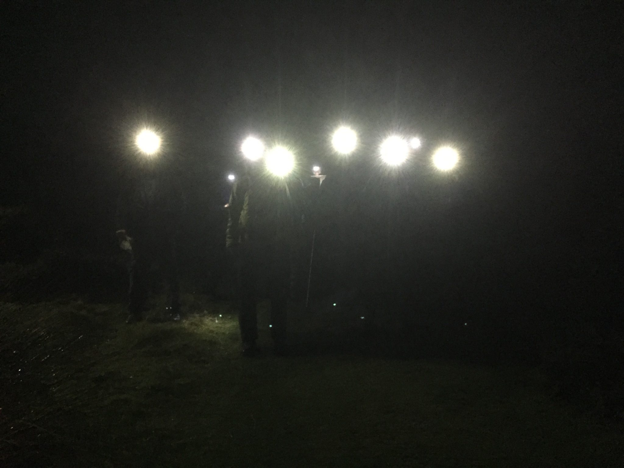
    Recent interest in the organised Moonlight Challenge and all this talk about a super moon reminded me of a time when we used to hold night hikes once a month from November to February, on the Friday night nearest to the full moon.

    These were all night affairs and on each of these trips we would have a nominal leader, plus half-a-dozen rival candidates for the post, which often led to some good humoured banter.  Sometimes we had moonlight, sometimes we had cloud and rain and, sometimes, we had snow.

    The shortest of these walks was the Glenealo Horseshoe, starting from the hut.  We tackled Lug from several different points.  Starting from Glenmalure we climbed Lug via Art’s Lough and a scramble up Bendoo, returning via Cannow and Table Track.  From Aughvannagh we approached via the Ow Valley and the main gully in the South Prison, continuing on via the Three Lakes and Camaderry, and down to Laragh in time to catch the St. Kevin’s early morning bus back to town.

    If the weather was wintry enough we would head up from Fenton’s pub at Seskin, bringing the tents with us for our winter camp on the summit.  From Knockree we crossed Maulin and Djouce, down to Lough Dan, on up to the Military Road and up and over Tonelagee and down for the bus.  From Blessington we went via Sorrel Hill, Black Hill and Billy Byrne’s Gap to Mullaghcleevaun and on to Tonelagee and Laragh.

    On one of these excursions we had deep snow drifts and dense mist all the way from Billy Byrne’s Gap, making for tough going and difficult navigation, but Joan Flanagan, our leader on the night, coped admirably.  We had our reward as we descended towards Glendalough.  The skies cleared just before dawn and, as the sun peeped up over the horizon, it painted the snowy summit of Tonelagee a delicate, blushing pink, which ripened to a deep red, then orange and, finally a cheerful yellow.

    The most testing of these night hikes was the Lug Walk, which at one time was considered to be a must prior to any Alpine trip.  On one of our Lug Walks, with Des Doyle as leader, we had starry skies, a full moon and a sharp frost.  Visibility was excellent, there was no call for map or compass and we skipped along over frost-hardened ground.  Well, some of us did.  Sean Barrett was breaking in a new pair of boots (plastic Koflachs, if I remember rightly) and by the time we got to Mullaghcleevaun, his feet were in rag order.  But he finished with the rest of us.

    There was a time when our club fostered interest and competence in walking by organising fortnightly Sunday walks during the winter months, details of the routes being published in the monthly newsletter, or revealed on the previous Thursday night, so that those who wished could plot the bearings beforehand and put them to the test on the day.  These walks started from a wide variety of locations in Wicklow and we also made day trips to the Cooleys, Mournes, Galtees and Comeraghs, areas which can be reached much more quickly and easier now, with the proliferation of motorways.  The walks took place regardless of weather conditions, on the basis that foul weather provided the best test of navigational skills.  The result of all of this was that the club always had a core group of experienced walkers, with a wide knowledge of our mountain ranges which they were always happy to pass on to newer members.

    Learn by Doing was the tried and trusted concept back then and it worked admirably well.  Nowadays the emphasis is on doing courses, but it never ceases to surprise me that anyone, least of all the members of a mountaineering club, should feel it necessary to take formal instruction in something as basic as hill-walking.  The thing is, for donkey’s years Dubliners, as children and as adults, have enjoyed walking in the Dublin/Wicklow mountains, without fuss or palaver.  When An Oige was in its heyday, back in the fifties and sixties, their Wicklow hostels would be packed to capacity every Saturday night as young people explored the nearby mountains.  As chisellers in Harold’s Cross, gangs of us would regularly throw a couple of hard-boiled egg sambos into our schoolbags and head off for a day in the hills and no-one would look up or down at us.  It was as common and everyday as using your jumpers for goalposts when playing street football.  In those days the schoolbags would have been the only bit of kit we took with us but, nowadays, we are urged us to tog ourselves out in expensive gear and equip ourselves with all kinds of gadgets before setting out for the hills.  It wasn’t always thus.

    In his book, The Neighbourhood of Dublin, published back in 1912, Weston Joyce extolled the virtues of walking the Six Hills (the area between Stone Cross and Kippure) at a time when Dublin hardly extended beyond the canals and Glenasmole was so remote from the city that the Irish language had survived there until the nineteenth century.  And the gear Joyce recommended for these outings?  A pair of stout boots and a walking stick.  At that time I’m sure some would have regarded the use of a walking stick as smacking of ostentation.

    J.B. Malone, the doyen of Dublin hill-walkers, in his book, The Open Road, published in 1950, was frugal in his choice of gear, too. He recommended what was known as The Russian Roll.  This was a raincoat, rolled width-ways and worn like a bandoleer, draped over one shoulder and fastened beneath the other with the coat belt, with the lunch stowed in one of the pockets.  Many of us, in those frugal times, would have regarded owning a coat with a belt as being a blatant example of conspicuous consumption.

    Bill Murray, in his book, Undiscovered Scotland, recommended going out, alone, at night, in the depths of winter and trekking the snow-clad summits by moonlight, advice that would probably be frowned upon nowadays.  It is increasingly rare for us to be blessed with decent snow cover on our hills but, if the opportunity arises, you should try it.  The silence, the serenity and the soft, subdued light reflecting off the glittering snow slopes all adds up to a magical experience.

    Our mountains are small by international standards, but they can provide much enjoyment and, sometimes, challenges, too and learning to cope with these challenges may serve well elsewhere, on more distant hills.  So, go on, spread your wings, get your boots wet and test yourself.  After all, we are members of a mountaineering club.  Shouldn’t we be doing what it says on the tin.

  • Travelling Light in the High Atlas Mountains

    Travelling Light in the High Atlas Mountains

     “You must live in the present, launch yourself on every wave, and find your eternity in each moment.” – Henry David Thoreau

    Mount Toubkal, in the Moroccan high Atlas Mountains, is the highest mountain in North Africa.

    On a sunny morning in May, after leaving the hustle and bustle of Marrakesh, we find ourselves in the small Berber village of Imlil – the gateway to the high Atlas Mountains.

    Imlil
    Imlil

    Imlil is a small tourist village featuring a number of outdoor shops, guiding services, muleteers and places to stay.

    The journey to this isolated part of North Africa began after an après-hike conversation in the Wicklow Mountains, when a friend suggested climbing Toubkal.

    After having completed my Mountain Leader training program in Donegal a month earlier and with an enthusiastic frame of mind eagerly wanting to put my new navigation and survival skills to the test. I convinced my friend to do the climb without a guide and without the support of mules to carry our supplies.

    I did some research, ordered a 1:50,000 map of the high Atlas Mountains from Stanford’s map shop in London and now felt that I was ready to explore the highest mountains north of the Sahara desert.

    Standing in the small Berber village clutching my map and compass with a 10 kg backpack, I reflected on how it is the simplest things in live that provide the most happiness and value.

    The weight of a backpack can be a good metaphor for travelling lightly without clutter throughout ones life.

    I find myself thinking of a quote by the nineteenth century American transcendentalist, Henry David Thoreau

    “A man is rich in proportion to the number of things which he can afford to let alone”

    The stuff that you have in a backpack becomes a very mindful burden when it has to be carried for six hours up a 1500 meter ascent over 10 kilometers. The journey becomes a contemplation of what is necessary and what, as Thoreau would say, ‘can be let alone’.

    The village of Imlil is situated at the base of the high Atlas Mountains at an altitude of 1,749 meters. Following the main road through the village we reach a well-marked track that begins our ascent towards the refuge which will become our base-camp.

    Leavinvg Imlil
    Leavinvg Imlil

    The beaten track is well marked and one would nearly be inclined to dispense with the map and compass.

    However, as the day unfolds and the evening approaches the map will become a vital necessity.

    At this early stage, we are enjoying the blue skies and the beautiful scenery. We pass many other trekkers using guides and mules.

    Passing mules on the small tracks requires some awkward maneuvering: firstly to get out of the way of the mules and secondly to avert my friends gaze as I’m sure he must be thinking ‘why are we carrying all of our luggage up the mountain, when no one else is?’.

    Hiking up this valley is a very relaxing experience and there are many little shops along the way to buy provisions.

    Along the way, we have a very friendly conversation with a local young man and his father who are gathering sand to build a house.

    The Berber people in the mountains don’t have very much, but they appear to be very happy and contented. Tourists that go to the markets of Marrakech will encounter some persistent selling and may leave the country with a less than positive impression. But when you go beyond the tourist hotspots you encounter a real genuine people, who are living simply and are just trying to get by.

    After half an hour, we reach the village of Aroumd (the locals pronounce it as “aremd”) – a real authentic Berber village.

    Sidi Chamharouch
    Sidi Chamharouch

    Next we pass the tiny settlement of Sidi Chamharouch. This little settlement has grown around a Muslim shrine and is a local pilgrimage site.

    From here the path crosses a stream with a quaint little waterfall and climbs steeply uphill to the right side of the Isougouane valley. This is the halfway point between our climbing that started in Imlil and will finish at the refuge base-camp.

    We continue on for another few hours but the higher altitude brings a slower pace.

    As we near an altitude of 3,000 meters the change in altitude is much more noticeable. Breathing is deepening, walking feels harder, and I can feel my ears popping every so often. We are becoming very tired now.

    As we hike on, I notice dark clouds forming. I say nothing to my friend but take note of emergency shelters that we pass along the way. Visibility is falling sharply too, as clouds and mist start covering us. Suddenly visibility is down to 100 meters. We can still see the well-trodden path.

    But as we continue, visibility is now down to 20 meters and even the track becomes less distinct. The large shadows create mirages of what might be the outline of our refuge but turn out to be just hauntingly large boulders.

    There is something about mist in the mountains and the shadows that they form, which stokes the imagination and conjures up all kinds of supernatural fantasies. Although a world removed from the moors of Yorkshire, there is a haunting sense of mystery that might be described in a Bronte novel. I am studying my map closely and estimate that we should be at the refuge, but we can’t see a thing except fog. Suddenly, the large outline of a refuge appears. Had we diverted more than 20 metres from the track, we would have completely missed it.

    Les Mouflons refuge
    Les Mouflons refuge

    We arrive at the refuge around six o’clock and fortuitously they still have plenty of spare beds. This refuge is located at an altitude of 3,207 meters or 960 meters below the summit.

    The electricity in the refuge is rationed – being switched on from 7:00 pm to about 10:00 pm, which is the only window to recharge any electronic devices.

    After a long walk in the fresh air of the mountains, nothing beats a fine meal. We are served a large and delicious Tagine, which is something like an Irish stew but with several different spices added.

    Sleeping at altitude takes some getting used to and despite being tired my sleep is disrupted.

    The next morning at about 8:00 am, we start our summit attempt.

    Still Snow in May
    Still Snow in May

    From the refuge, we follow the path that crosses the stream and then leads into a snowfield. Although it is already late in May there is still a lot of snow remaining. Climbing in the snow isn’t much of a problem, and although crampons would have been useful, they weren’t necessary at this time of the year.

    After the snowfield, we approach a steep scree slope to the east and enter a valley to eventual reach a col (a col is a low point between two peaks) between Toubkal and Toubkal West. This col is called “Tizi’n’Toubkal” and sits at a height of 3,940 metres.

    At this col, we take the route to the left (northwards) towards the summit ridge of Mount Toubkal. The track to the summit is obvious and quite steep, but flattens off at the summit.

    Mount Toubkal Summit
    Mount Toubkal Summit

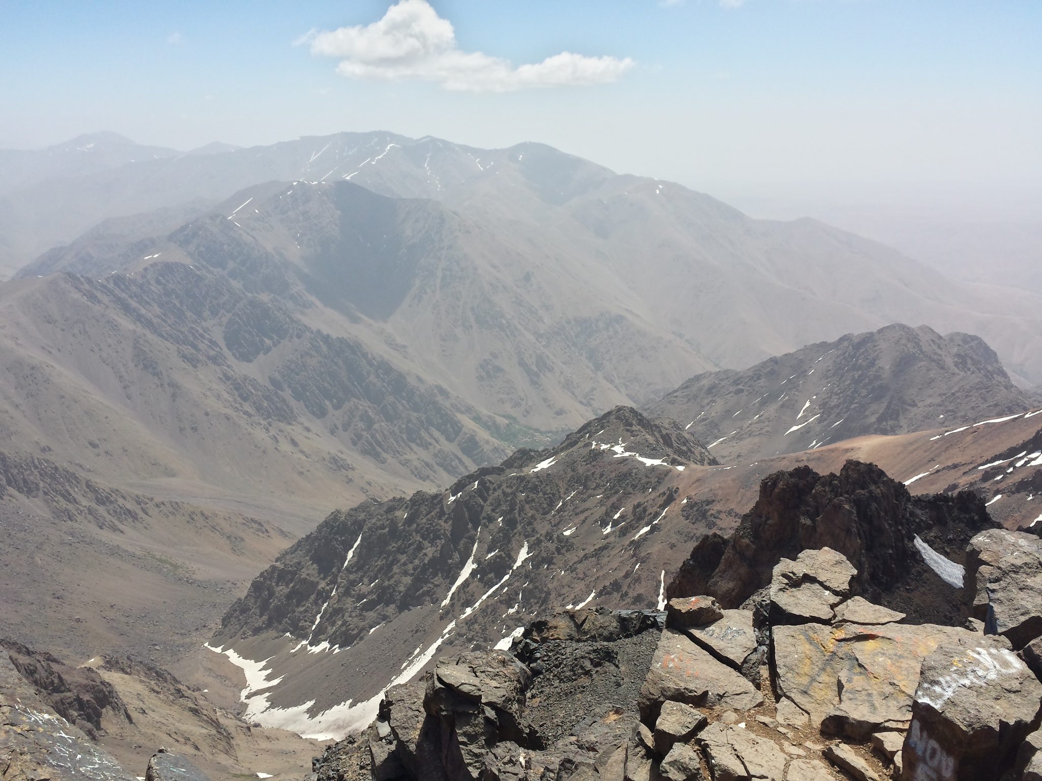
    The summit, at a height of 4,167 metres (13,671 feet), is marked with a pyramidal metal structure.

    Europeans first ascended this peak in 1923. Today, 92 years later, on the 20 May 2015, we reach the top of this beautiful mountain.

    Feet in the clouds
    Feet in the clouds

    The effort of the climb was rewarded with amazing panoramic views of the Atlas Mountains with some streaks of snow that hadn’t yet melted.

    Let sleeping dogs lie
    Let sleeping dogs lie

    Curiously, we found a dog sleeping on the summit. Later we learned that every morning this dog follows trekkers to the top and then returns in the evening to the refuge to be fed.

    We descend by the same route to the col (Tizi’n’Toubkal), and then continued straight on to reach another summit—Toubkal West (4,033 metres).

    After having climbed two 4,000 meter peaks in one day, we retrace our route back to the refuge and then return to the village of Aroumd.

    Aroumd, at a height of 1,850 meters, is about half an hour’s walk from Imlil and is the largest village in the Mizane valley.

    a18_MizaneValley_FloraThe tiered fields consisting of barley, walnut trees, cherry trees, onions and potatoes, contrasts with the arid landscape of Toubkal. The track into the village is surrounded with very fragrant purple and yellow flora.

    That night, we stayed in a local gîte offering stunning views of the Mizane valley from its large terrace. The local Berber people of this village live a very simple life but appear to be quite happy and relaxed.

    The next day we used the services of a guide to explore the Mizane valley.

    Towards the end of the week we returned to Marrakech and then flew back to our beautiful emerald isle.

    We spent most of our week’s trip to Morocco in the mountains. The stunning beauty of these mountains surpassed my expectations and I look forward to returning someday. There is so much to see and do that one could spend months here.


    INFORMATION ON CLIMBING TOUBKAL

    In May of 2015, the exchange for the Moroccan Dirham (DH) was approximately 11 DH to €1. The prices shown below are based on this conversion rate.

    Travel to Morocco:

    Ryanair return flights from Dublin to Marrakesh: €120From the Airport, take the number 19 bus (€3) to the Jemma El Fna (Marrakech main square).

    Accommodation in Morocco

    There are a number of hotels near Jemma El Fna in the Medina. We stayed in the Sindi Sud hotel (€ 21 per night per room for two people), which was basic but comfortable and clean.

    Transport to Mountains

    The taxis which take you to the mountains are called “Grand Taxis”, as opposed to the “Petit Taxis” that are used in the city.

    Take a Petit Taxi (€ 2) to the Grand Taxi rank at the Bab er-Rob taxi rank.

    The journey from Marrakech to the village of Imlil is about 90 minutes. A shared taxi will cost about €5 per person sharing or about € 15 for an un-shared taxi, but be prepared to spend some time haggling to get that price.

    Getting a taxi from Imlil back to Marrakech is more expensive and will cost €20 to €30 for a private taxi.

    Mountain Refuge

    There are three mountain huts clustered close together, with the lowest one being Les Mouflons.The Les Mouflons refuge costs €30 half-board per night.

    Guides

    Guides are available in Imlil and you will also meet them along the route and at the refuge. To get a good price, you will need to haggle. There are also options to use mules to carry your gear.

    Hiking around the village Aroumd

    A Gite with half-board (bed, evening meal and breakfast) should cost around €15 / night / person.


  • "A Long Walk South" by Sean Rothery (reviewed by Niall Ennis)

    "A Long Walk South" by Sean Rothery  (reviewed by Niall Ennis)

    Sean Rothery is a retired architect and architectural historian, he still lecturers in Ireland and abroad. More importantly Sean is an Honorary Member of the Irish Mountaineering Club and a lifelong lover of walking and mountaineering.
    A Long Walk South is the story of a journey, the entire GR5, the “Grande Randonnèe Cinq”. Sean travels the 2,300km route from the Hook of Holland through the Dutch Lowlands, Belgium, Luxembourg and France. The Vosages and Jura mountains are traversed before Sean reaches the Alps and continues his journey towards Nice, on the Mediterranean.
    This book recounts the ups, downs, frustrations and elations encountered over the four month walk. The book is in diary form starting on the 10th May where a naked run into the North Sea begins the massive trek to the Mediterranean. Freed from the slavery of the workplace and under a doctor’s “advice” Sean starts to walk a few miles a day, complete with full backpack and passport! The early sections of the journey are flat and travel through small villages, suburban landscapes and along canal pathways. He journeys along meandering rivers and through forest trails in the Ardennes, site of the Battle of the Bulge.
    By the start of June Sean is fitter and convinced that he will reach Nice and complete the journey. One night in a hotel he is awoken, by an annoying noise, which he describes as a “radio taxi”, Sean responds by shouting (and more than likely waking the entire hotel) that the noise is keeping him awake, “I stop” is the response. We could do with Sean down in the IMC Hut some nights!
    Having travelled for nine days with walking companion Sally, Sean finds himself travelling alone again. A sense of that solitude is reflected when in June he reaches the Vosges Mountains, a natural frontier between France and Germany.
    The way-marks change as Sean encounters a maze of marked trails, this is certainly bewildering to most Irish people who only have to negotiate the likes of the “Little Yellow Man” as our way-marks! Later on travelling with two companions Sean reaches a “squalid” gite in the town of Novel from where they journey through Alpine pastures moving in the direction of Mount Blanc.
    With over 1600km completed, new boots are required before the mountain challenges and thunderstorms that the northern Alps gift to the long distance walkers. Before reaching the Chamonix Valley Sean recounts the story of how his climbing career was cut short in an accident in the Alps.
    By the end of August Sean is in the Alps Maritimes, its warm the mood is good (how could it not be?) in one of the nicest places in Europe. Walking through the aches and pains the body demanding a proper rest Sean continues. There is a smell of the sea in the air, where a swim in the warm Mediterranean awaits.
    Hikers from all over the world take on challenges involving GR routes each year, I know many people, myself included, who have hiked the GR5 from Geneva to Nice, but reading Sean’s journey I feel like I took a short cut. For anyone with an interest in hiking, backpacking, travelling and long distance walking this is a great read. Sean leaves the reader with an understanding of what long distance journeying all this is about. If Nicholas Crane’s “Still Waters Rising” is on your bookshelf then Sean’s book should be beside it, if not, go out and buy both.
    Reviewed by Niall Ennis

Previous Page
1 2 3 4 5
Next Page

Postal Address

Irish Mountaineering Club
Glendasan
Glendalough
Co. Wicklow
A98 EY91
Ireland

Follow us on Social Media

  • Facebook
  • Instagram

IMC Website

  • Contact Us
  • Introduction
  • Hut